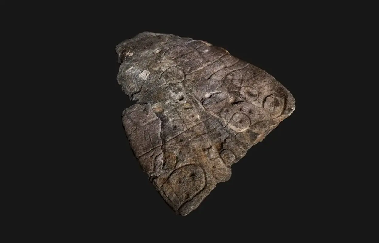
Archaeologists have confirmed that the Saint-Bélec slab is a “treasure map”, revealing previously unknown ancient sites in north-western France.
The Saint-Bélec slab was discovered in 1900 by Paul du Châtellier in a prehistoric burial ground in Finistère, where it formed part of an early Bronze Age cist structure. Du Châtellier stored the slab at his home, Château de Kernuz, where it was forgotten until its rediscovery in 2014.
The slab is made from a grey-blue schist, thought to originate from rocky outcrops from the Precambrian period found close to Douarnenez in the region of Brittany.
The surface is engraved with geometric shapes such as lines, circles and squares, interpreted as symbols representing settlements, barrows and fields. According to the researchers, the symbols on the slab matched the landscape of the Odet valley in Finistère, with lines used to represent the river’s tributaries.
Recent excavations by archaeologists from the University of Western Brittany (UBO), have uncovered additional fragments belonging to the Saint-Bélec slab at the original discovery site. The fragments complete the puzzle, providing new evidence to indicate that the Saint-Bélec slab was indeed a map that could lead to many previously unknown ancient sites.
The results of a study, published in the journal Bulletin de la Société préhistorique française, suggests that the topography of the slab was deliberately modified to show motifs representing structures from the Bronze Age, as well as enclosures, plot systems, tumulus, and roads.
According to the study: “The central motif on the Saint-Bélec slab could be interpreted as a central place of an early Bronze Age territory. One outstanding question is why it was made?”
“One possibility is that such a territorial depiction was a material and symbolic act. Set alongside the contemporary development of field systems in Brittany, the making of the slab suggests perhaps the appearance of a new form of land tenure, while the distribution of elite graves is closely linked to soil fertility. Against this background, we can hypothesize that the Saint-Bélec slab was used as a cadastral plan for managing the territory and controlling land.”
University of Western Brittany (UBO)
Header Image Credit : Denis Glicksman


