Date:

120 archaeological sites identified through aerial lidar mapping

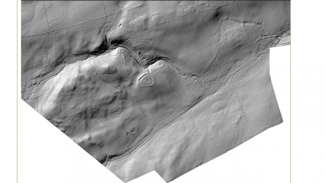
An aerial mapping project undertaken by the National Trust on the Wallington Estate in Northumberland, England, has identified 120 new archaeological features, including prehistoric sites from as early as 2000 BC.

Light Detection and Ranging (LiDar) is a method of remote sensing using light in the form of a pulsed laser to measure ranges (variable distances) to the Earth. The differences in the laser return times and measuring the wavelengths can be used to compile a 3-D digital map of the landscape, removing obscuring features such as woodland that could hide archaeological features.

- Advertisement -

The technology was applied to the National Trust’s Wallington 13-hectare estate, where the trust is identifying potential sites for planting 75,000 British native trees, as part of a project to plant 20 million trees by 2030 in order to help tackle climate change.

The lidar-created map found evidence of archaeological sites dating from 2000 BC to AD 1900, including traces of historic, healthy woodlands dating from the mid-eighteenth century which were cleared and not replanted.

Other findings include the discovery of early farming systems which were cast aside in the 18th century by the previous owner of the estate, and at least half a dozen different forms of ‘ridge and furrow’ cultivation.

Previously known Iron Age camps and hillforts have been surveyed with greater precision to reveal eroded outlying features; such as possible annexes to the main enclosures; linear features, and suspected prehistoric pathways.

- Advertisement -

National Trust archaeological consultant Mark Newman said: “This is an exciting moment in the 5,000-year history of this special estate. The lidar findings have shone a light on much more than we could have imagined so that we can better understand the history of the landscape to help inform plans for its future.”

Additional fieldwork to record the landscape will be carried out before planting begins in November to complement the lidar remote sensing.

National Trust

Header Image Credit : National Trust


- Advertisement -

Stay Updated: Follow us on iOS, Android, Google News, Facebook, Instagram, Twitter, Threads, TikTok, LinkedIn, and our newsletter

spot_img
Mark Milligan
Mark Milligan
Mark Milligan is a multi-award-winning journalist and the Managing Editor at HeritageDaily. His background is in archaeology and computer science, having written over 8,000 articles across several online publications. Mark is a member of the Association of British Science Writers (ABSW), the World Federation of Science Journalists, and in 2023 was the recipient of the British Citizen Award for Education, the BCA Medal of Honour, and the UK Prime Minister's Points of Light Award.
spot_img
spot_img

Mobile Application

spot_img

Related Articles

Celtic skull trepanation tool discovered in Mazovia

Archaeologists have discovered a rare Celtic tool used for skull trepanation during excavations at the Łysa Góra site in Mazovia, Poland.

Traces of prehistoric tombs and settlements excavated on Northern Herm

Herm is one of the Channel Islands and part of the Parish of St Peter Port in the Bailiwick of Guernsey.

Rare silver-tipped stylus among new discoveries at the “Gates of Heaven”

Archaeologists from the Saxony-Anhalt State Office for Monument Preservation and Archaeology (LDA) have unearthed a rare silver-tipped stylus during excavations at the Himmelpforte Monastery, otherwise known as the “Gates of Heaven”.

Epigraphists identify Ix Ch’ak Ch’een – the woman who ruled Cobá

Archaeologists and epigraphists have identified Ix Ch’ak Ch’een as a ruler of the ancient Maya city of Cobá during the 6th century AD.

New study shifts the dating of major Bronze Age events

A new study published in the journal PLOS ONE presents new evidence that the volcanic eruption of Minoan Thera (modern-day Santorini) occurred before the reign of Pharaoh Ahmose I, overturning long-held views of Bronze Age chronology.

Archaeologists uncover 5,500-year-old monumental landscape in Jordan

Archaeologists from the University of Copenhagen have uncovered a large 5,500-year-old monumental landscape at Murayghat in the rocky hills of central Jordan.

Major discoveries at Bremenium Roman Fort

Located in Northumberland, England, Bremenium was constructed around AD 80 to defend an extension of Dere Street, a Roman road running from York to Corbridge north of Hadrian's Wall.

Roman fort found on occupied Kerch Peninsula

Archaeologists from the South Bosporus Expedition have found a Roman fort during excavations on the occupied Kerch Peninsula, Crimea.