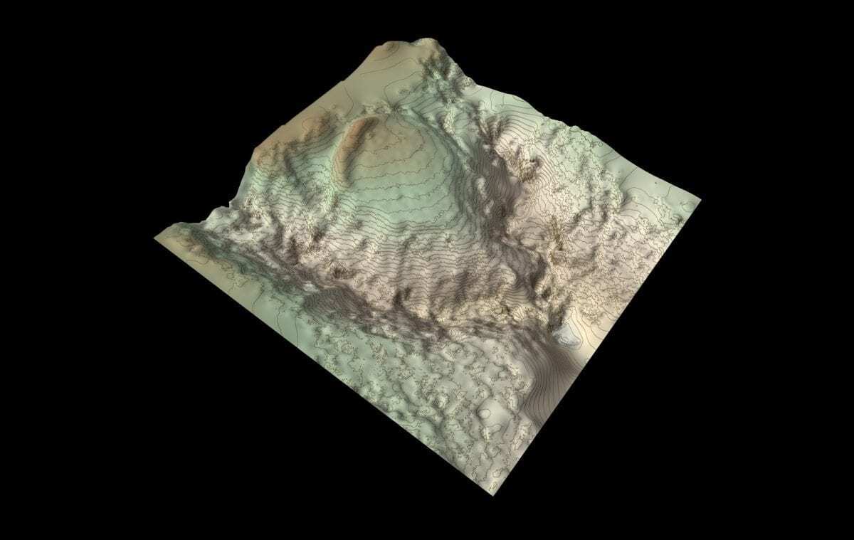
Forestry and Land Scotland has undertaken an archaeological survey of Wallace’s House, a fort reputed to have been built by William Wallace.
The fort is located near Lochmaben, north-west of Lockerbie in Scotland and was first recorded in the “New Statistical Account of Scotland” published between 1834 and 1845.
The 19th-century records noted “a small fort, commonly called Wallace’s House, adjoining Torlinn, a glen filled with natural oak. This fort commands an extensive view to the south, occupying the summit of an angle formed by the junction of two branches of that steep ravine; and being protected on its third side by a large fosse [or ditch], it must have been a strong place of defence. Sir William Wallace, while meditating the capture of the castle of Lochmaben in 1297, is said to have kept sixteen men there, with whom he sallied forth to annoy the English garrison under Greystock and Sir Hugh of Moreland.”
William Wallace was a Scottish Knight who became one of the main leaders during the First War of Scottish Independence. Wallace, along with Andrew Moray defeated the English at the Battle of Stirling Bridge and was appointed Guardian of Scotland.
Wallace was captured in 1305 and taken to Westminster Hall, where he was tried for treason and for atrocities against civilians in war, “sparing neither age nor sex, monk nor nun.”
After the trial, Wallace was taken to the Tower of London, then dragged naked through the City of London to Smithfield where he was hanged, drawn and quartered (strangled by hanging, then released to be emasculated, disembowelled, beheaded and cut into four parts). His head was preserved in tar and placed on a pike on London Bridge as a warning to any further dissension.
The fort was surveyed by archaeologists using a remote-controlled drone, taking hundreds of aerial photographs in order to create a 3D terrain model, with refined contours and orthographic colour.
Forestry and Land Scotland Archaeologist Matt Ritchie said: “In recent years we have been working with Skyscape Survey to develop the methodology of drone-generated photogrammetric survey, combining accurate survey methods with innovative visualisation techniques.”
Our new 3D model enables the massive rampart of the fort to really stand out, and the deep gullies of the two linns to be appreciated. It really must have been ‘a strong place of defence’, the rampart topped with a timber palisade and enclosing timber buildings built to house the soldiers and their horses. Could the fort really have been built by William Wallace and his men? I’d like to think so – and, either way, the survey has added a new chapter to an old story!” Added Matt Ritchie.
Header Image Credit – FLS by Skyscape Survey 2020


