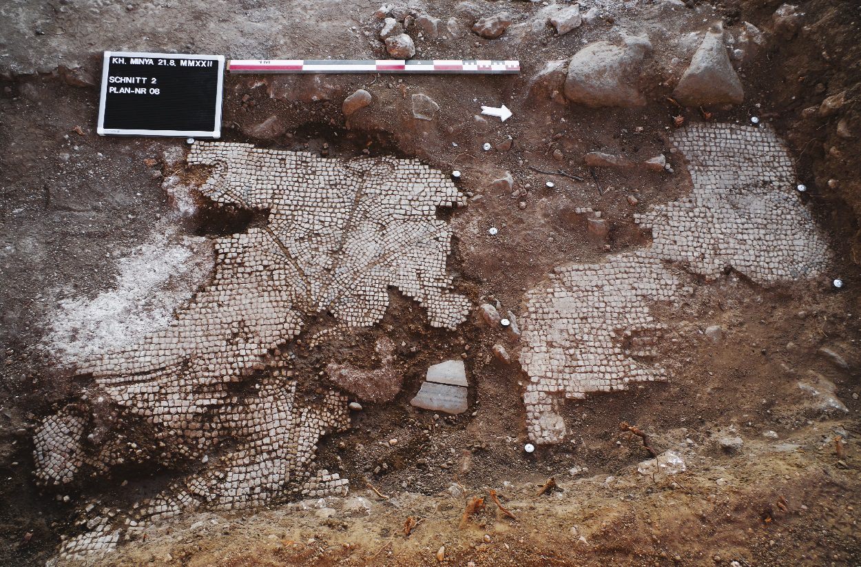
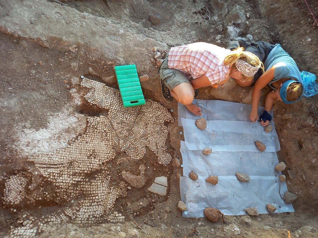
Archaeologists from the Johannes Gutenberg University Mainz (JGU) have discovered mosaics in a settlement near to the early Islamic caliph’s palace of Khirbat al-Minya on the shore of the Sea of Galilee.
Khirbat al-Minya is an Umayyad-built palace in the eastern Galilee, located almost 200 metres (660 ft) west of the northern end of Lake Tiberias.
Khirbat al-Minya served as a local administrative centre for a subregion of the Jund al-Urdunn (“District of Jordan”) and as a contact point for ‘Umar and local Arab tribes. It also could have served as a caravanserai for merchants travelling along the Sea of Galilee or northeast from the lake shore to the coast.
Using geomagnetic surface surveys and a series of test pits, the team discovered that in the early 8th century the caliph had commissioned the building of his palace, with its incorporated mosque and a 15-meter-high gateway tower.
Archaeologists also found stone structures made of basalt from varying periods, a water cistern, plastered walls and ornate mosaic floors.
The mosaics date from around the 5th to 6th century AD, depicting so-called Nile-scene images of flora and fauna native to the Nile valley in Egypt. Similar examples can be found in nearby churches, such as the Church of the Multiplication in Tabgha.

Ceramic finds from the 5th to 7th century AD, in combination with the discovery of the mosaics, indicate that a settlement predated the construction of the caliph’s palace. The settlement’s original inhabitants were either Christians or Jews, later joined by a small Islamic community, for whom the caliph had a side entrance constructed in the early 8th century so that they could access his palace mosque.
The unearthed ceramics have revealed that the site remained occupied under the control of the Umayyad and then Abbasid caliphates from the 7th to the 11th century. New construction projects were initiated in this period during which, parts of the mosaics fell victim to iconoclasts and sections of old walls were demolished.
Nearby, the Mainz team also exposed a stone-built furnace used to process sugar cane. Although sugar cane represented one of the top agricultural exports of the Holy Land from the period of the early Middle Ages, vast volumes of water were needed to cultivate it while large amounts of wood were required to operate boiling furnaces. The result was extensive soil erosion and an environmental disaster that the area around the lake had not fully recovered from even by the 20th century.
“Our most recent excavations show that Caliph Walid had his palace built on the shore of the Sea of Galilee in an already carefully structured landscape that had long been inhabited. It was here that considerable money was subsequently made through the cultivation of sugar cane, sadly causing lasting damage to the ecosystem,” said Professor Dr. Hans-Peter Kuhnen from Johannes Gutenberg University Mainz. “Our research has brought this settlement adjacent to the caliph’s palace to light again, putting it in its rightful context among the history of human settlement of the Holy Land. Over the centuries, it experienced alternating periods of innovation and decline, but there was no real disruption to its existence during its lifetime.”
Johannes Gutenberg University Mainz
Header Image Credit : Johannes Gutenberg University Mainz


