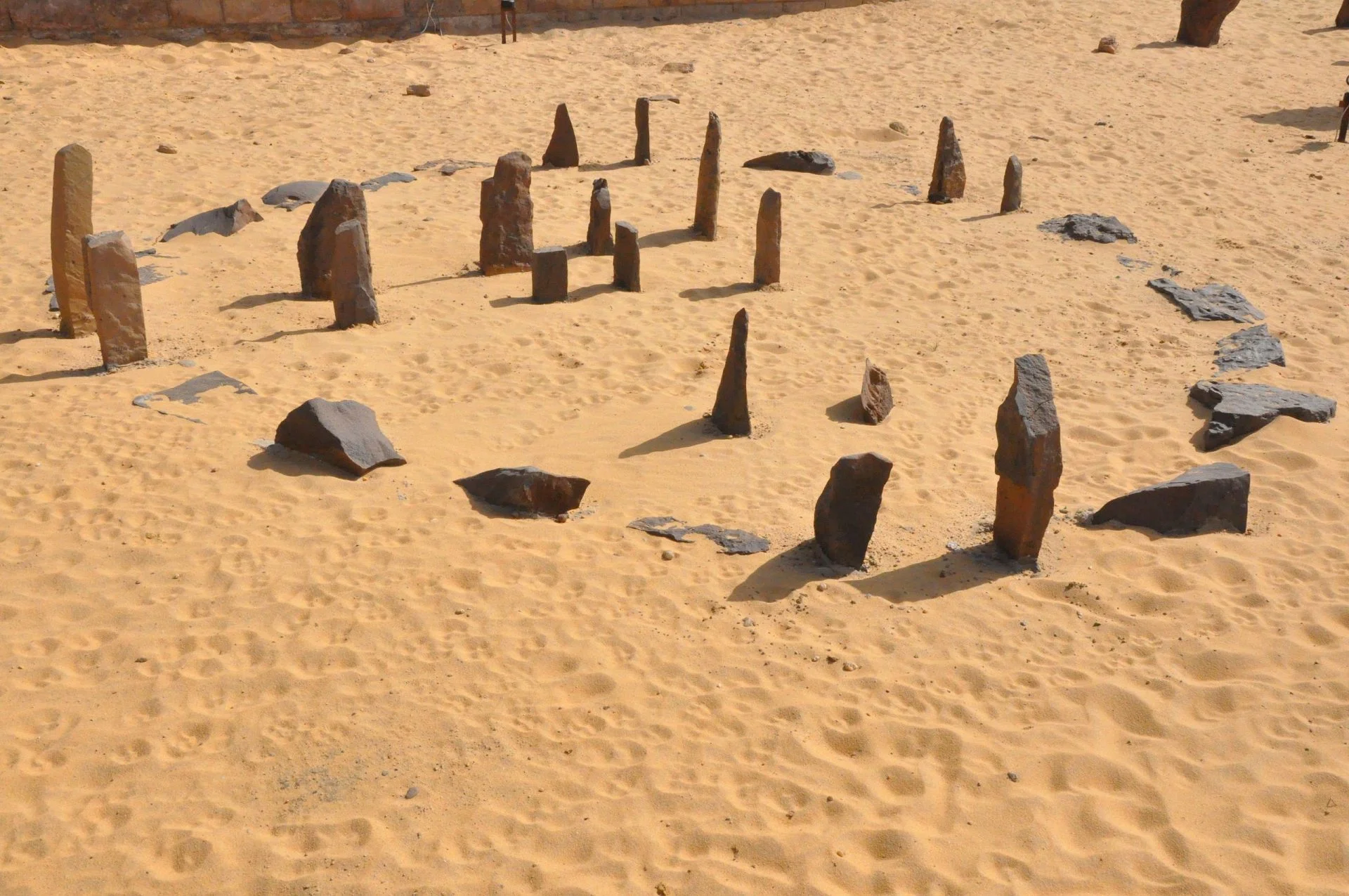
Nabta Playa is one of the earliest recorded sites from the Egyptian Neolithic Period, located west of Abu Simbel in the Al Wadi Al Gadid Desert.
As far back as 130,000 years ago, the arid desert we see today saw humid periods that altered the landscape, forming a grassland savanna that supported buffalo, giraffes, and varieties of antelope and gazelle.
Around 9000 BC, monsoon rains from central Africa would flood the basin and form a giant lake, attracting nomadic pastoralists who settled in seasonal camps along the lake shore. Osteological data suggests that these people originated from sub-Saharan Africa, but a dental and skeletal analysis also shows possible North African indications.
By the 7th century BC, larger organised settlements formed that sustained themselves throughout the year by digging deep wells. They lived in organised villages with linear positioned huts, bringing sheep and goats to the region for the first time from southwest Asia.
Nabta Playa emerged as a regional ceremonial centre during the Middle Neolithic period from 6100– 5600 BC, where people would gather periodically to conduct ceremonies during the wet seasons. Archaeological studies have identified hundreds of hearths, cultural debris and numerous cattle bones which represented wealth and power amongst the people for rare sacrifices.
Following a major drought which drove earlier groups from the desert, the Late Neolithic began around 5500 BC with a new group of people called the the Ru’at El Baquar people (the Cattle Herders). The Ru’at El Baquar developed a cattle cult, placing cattle burials in clay-lined and roofed chambers covered by rough stone tumili, that some scholars suggest was an early evolution of Ancient Egypt’s Hathor cult.
During the Terminal Neolithic from 4600 BC, complex megalithic structures were constructed in the Nabta Playa by people known as the Bunat El Ansalm, or Megalith Builders. They built structures or tumuli set in silt, with some of the tumuli topped with upright standing stones arranged in an oval formation.
It has been suggested that the formations are early archeoastronomical devices, indicating the rising of certain stars and a “calendar circle” that shows the direction of the summer solstice sunrise. A more prominent theory proposes that the positioned stones served as stele, perhaps to represent the dead and may have functioned as a symbolic necropolis.
There is some element of astronomical observation in the structures, the repetitive orientation of megaliths, stele, human burials and cattle burials toward the northern regions of the sky reveals a very early symbolic connection to the north.
In a paper by John McKim Malville from the University of Colorado Boulder, he suggests that “the groups of shaped stele facing north may have represented spirits of individuals who died on the trail or locally. The second bit of evidence for astronomy is found in the cromlech with its two sightlines toward the north and toward the rising sun at the June solstice. Finally, the alignments of stele, which were oriented to bright stars in the fifth millennium, suggest an even more careful attention to the heavens.”
Header Image : Reconstructed Nabta Playa stone circle – Image Credit : Raymbetz – CC BY-SA 3.0


