Date:

Archaeologists have mapped the capital of the Mongolian Empire

Archaeologists have mapped Karakorum, the capital of the Mongolian Empire using advanced geophysical methods.

Karakorum, also called Kharkhorin was founded around AD 1218–20, when Genghis Khan established a town of yurts at Karakorum to rally his troops during his campaigns against the Khwarezm Empire.

- Advertisement -

Karakorum developed into a city during the reign of Ögedei Khan (the third son of Genghis Khan and second Great Khan of the Mongol Empire). Under Ögedei and his successors, Karakorum became the traditional capital of the Mongols and an important centre of diverse religious microcosm and mercantile trade along the Silk Road.

In a new study published in the journal Antiquity by an international team of researchers, archaeologists applied advanced geophysics methods to reveal the layout of Karakorum’s roads, districts, and internal structures.

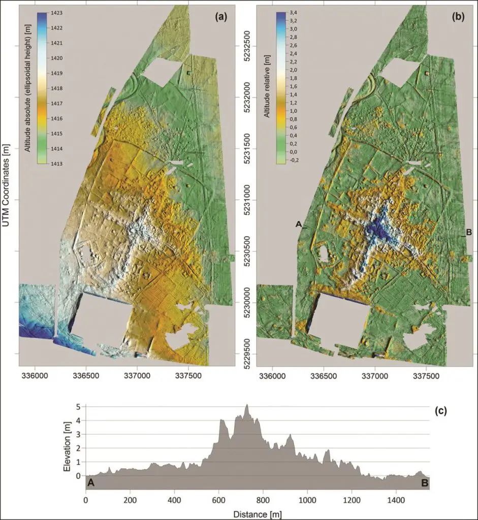
The team surveyed an area of 465ha over 52 days with a ‘SQUID’ (Superconducting Quantum Interference Device), that measures the topography of the surface and magnetic fields of the ground beneath.
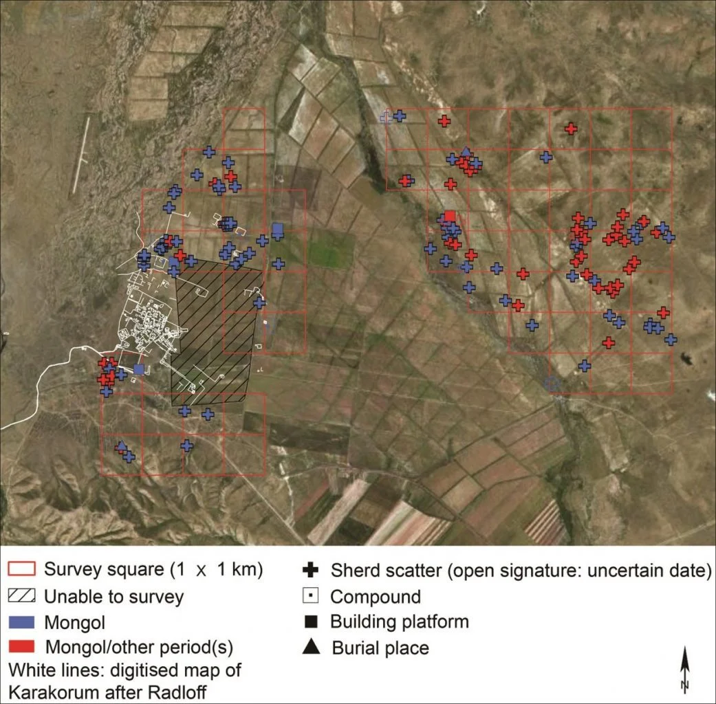
Figure 3 FINAL
Image Credit : Antiquity

By combining this data with previous surveys, aerial photography, and historical records, the team was able to create a detailed map of Karakorum that shows the inner layout, and the extent of the city beyond the actual walled area, as well as the social organisation of the city’s population.
- Advertisement -
Figure 6 FINAL 1
Image Credit : Antiquity

The team also mapped the city walls, revealing three of the four main gates documented in the historic record. Outside of these walls, they found the city extended over 3km along some of the approaching roads – far greater than other research and historical records indicated.
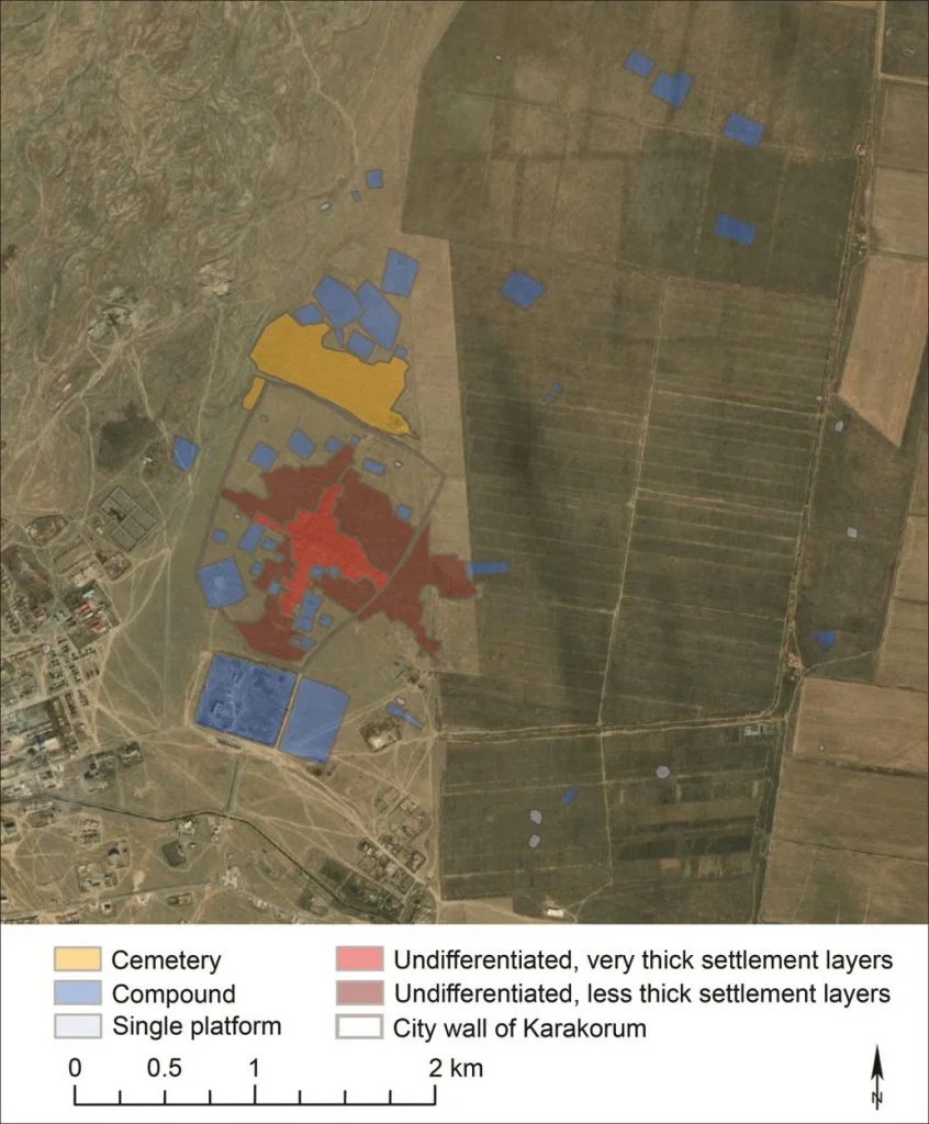
Figure 5 FINAL
Image Credit : Antiquity

Further, the study found that the centre of the city had much denser deposits, suggesting these were the areas of the city occupied for the longest period. However, the team ultimately found the biggest single feature of Karakorum was nothing. 40% of the area within the wall appears to have been left empty.

“The most exciting facet of our work for me was to see the progress of data acquisition during the field season.” said said Professor Bemmann, lead author of the study, “It was astonishing to witness the growing extent of the map day by day, and with that the digital reconstruction of Karakorum”. Find out more

Antiquity

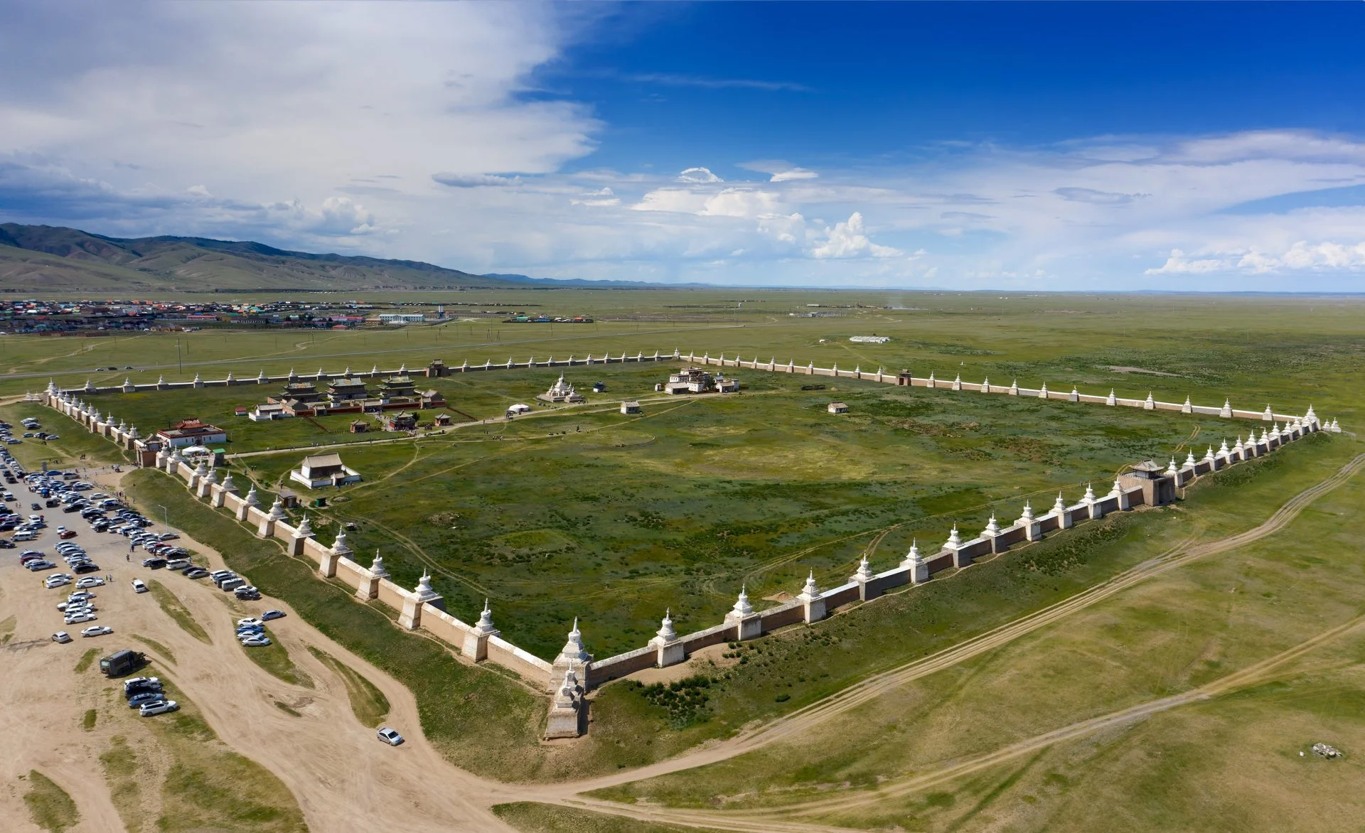
Header Image – Kharkhorin Erdene Zuu Monastery in Kharkhorin – Header Image Credit : Kokhanchikov – Shutterstock

- Advertisement -
spot_img
Mark Milligan
Mark Milligan
Mark Milligan is multi-award-winning journalist and the Managing Editor at HeritageDaily. His background is in archaeology and computer science, having written over 7,500 articles across several online publications. Mark is a member of the Association of British Science Writers (ABSW), the World Federation of Science Journalists, and in 2023 was the recipient of the British Citizen Award for Education, the BCA Medal of Honour, and the UK Prime Minister's Points of Light Award.
spot_img

Mobile Application

spot_img

Related Articles

Underwater scans reveal lost submerged landscape

Researchers from the Life on the Edge project, a collaboration between the University of Bradford and the University of Split, has revealed a lost submerged landscape off the coast of Croatia using underwater scans.

Buried L-shaped structure and anomalies detected near Giza Pyramids

A geophysical study by archaeologists from the Higashi Nippon International University, Tohoku University, and the National Research Institute of Astronomy and Geophysics (NRIAG), have detected an L-shaped structure and several anomalies near the Giza Pyramids using geophysics.

Archaeologists search for traces of the “birthplace of Texas”

As part of a $51 million project, archaeologists have conducted a search for traces of Washington-on-the-Brazos, also known as the “birthplace of Texas”.

Archaeologists find moated medieval windmill

Archaeologists from MOLA (Museum of London Archaeology) have uncovered a moated medieval windmill during construction works of the National Highways A428 Black Cat to Caxton Gibbet improvement scheme in Bedfordshire, England.

Archaeologists find preserved Bronze Age wooden well

Archaeologists from Oxford Archaeology have uncovered a well-preserved Bronze Age wooden well in Oxfordshire, England.

Bronze Age treasures stolen from Ely Museum

Thieves have broken into Ely Museum and stolen historical treasures dating from the Bronze Age.

Dune restoration project uncovers intact WWII bunkers

A restoration project to remove invasive plants from dunes in the Heist Willemspark, Belgium, has led to the discovery of three intact WWII bunkers.

Recent findings shed light on the “Lost Colony” of Roanoke

Ongoing excavations by archaeologists from The First Colony Foundation have revealed new findings on the historical narrative of the "Lost Colony" of Roanoke.