Date:

New Detailed Map Reveals Extent of Ancient City of Pergamon

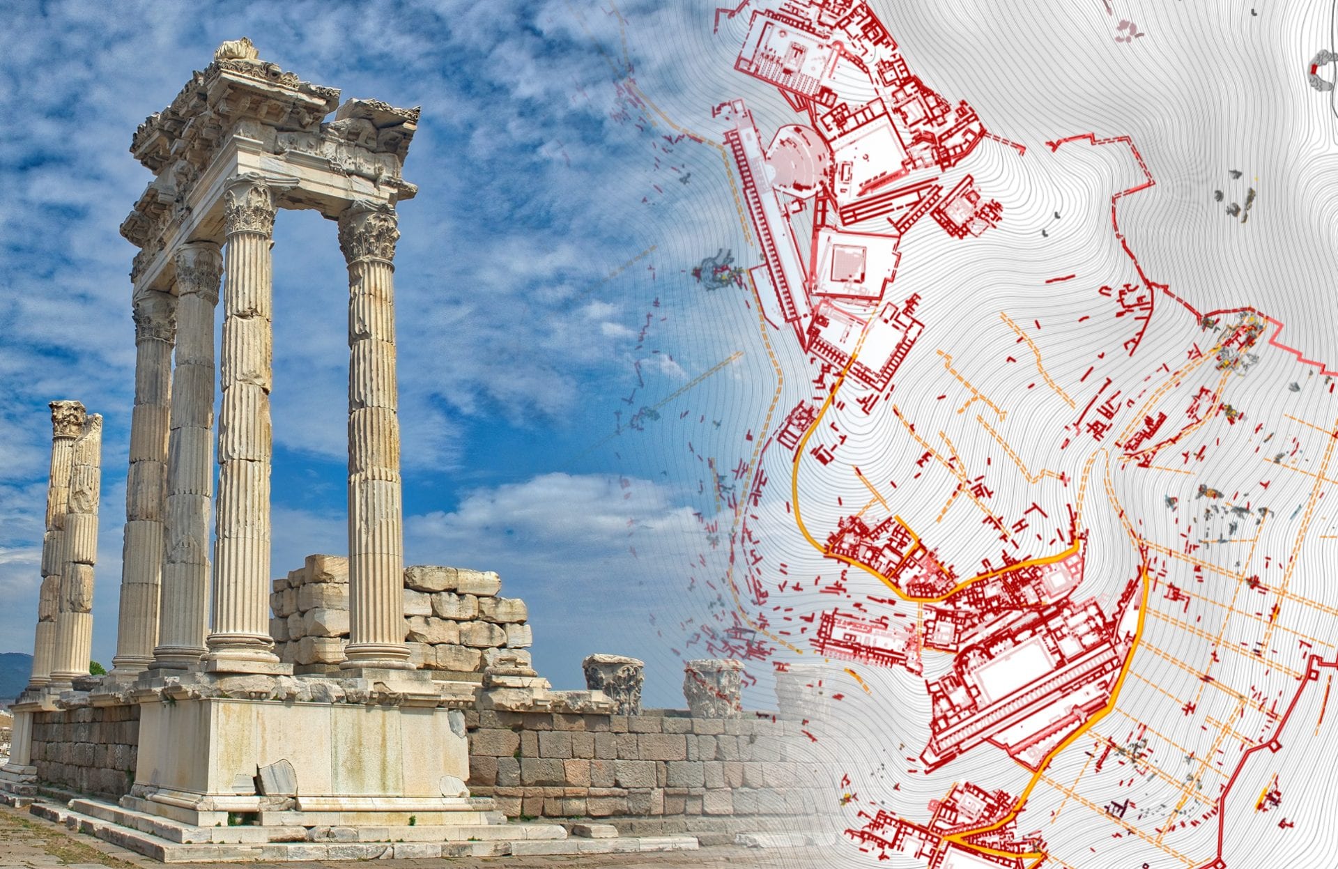
Archaeologists from the German Archaeological Institute, and the Turkish Ministry of Culture & Tourism has published a detailed cartographic digital map of the ancient city of Pergamon.

Pergamon was an ancient Greek city, located on the north edge of the Caicus plain near the present-day city of Bergama in Turkey. During the Hellenistic period, it emerged as the capital of the Kingdom of Pergamon (a rump state after the collapse of the Lysimachian Empire) that was ruled by the Attalid dynasty from 281 to 133 BC.

- Advertisement -

Pergamon became one of the major cultural centres of Asia Minor and the Greek world, being home to notable figures such as Epigonus (a Greek sculptor), Biton (a Greek writer and engineer), Hegesinus (a philosopher), Apollodorus (teacher to the Roman Emperor Augustus), and Antipas of Pergamum (a Christian martyr and saint).

Under the rule of Eumenes II and Attalus II, Pergamon reached its apex in 188 BC and covered an area of 220 acres. The goal was to create a second Athens, with an acropolis, the Library of Pergamon (which in contemporary sources is considered only second to the Library of Alexandria), various temples, and a large theatre that could seat up to 10,000 spectators.
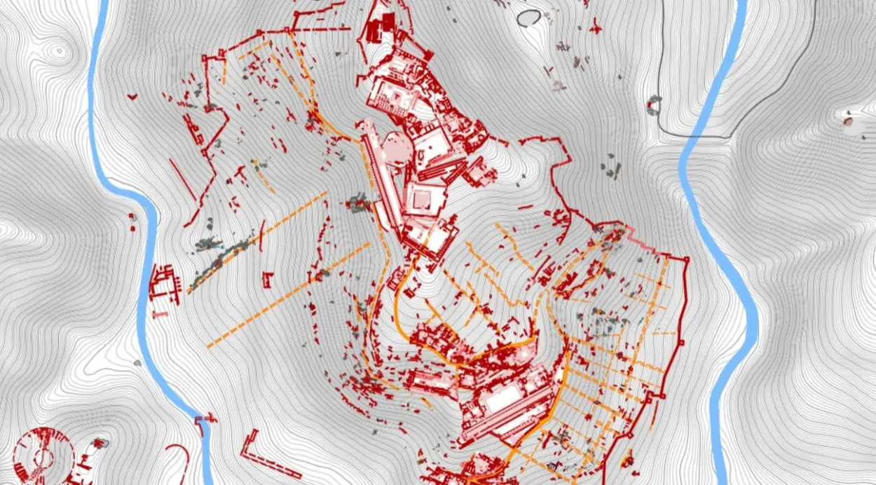
Image Credit : German Archaeological Institute

After the death of Attalus III in 133 BC, the city was gifted to Rome, leading to an uprising by a coalition of Greek cities in a series of Mithridatic Wars. The war resulted in Pergamon being stripped of its status as a free city, with the inhabitants being forced to pay tribute and supply troops to the Roman army.

The Romans conducted an ambitious building programme, constructing temples, a theatre, an amphitheatre, and the shrine of Asclepius (the god of healing) which was famed in the Roman world.

- Advertisement -

Pergamon continued to prosper, but during the crisis of the 3rd century AD (a period in which the Roman Empire nearly collapsed) the city began to decline and was badly damaged in an earthquake in AD 262.

The digital map published on iDAI.geoserver, is intended to show the culmination of decades of archaeological research over the last 30 years, revealing the true extent of the city monuments, and wider landscape over an area of 3088 acres.

Felix Pirson, honorary professor at Leipzig University and the first director of the German Archaeological Institute in Istanbul said: “We decided to adopt an open database system and share the ancient features of Bergama with the whole world. We want this information to reach a large number of people.”

View iDAI.geoserver Digital Map

Header Image Credit : German Archaeological Institute

- Advertisement -

Stay Updated: Follow us on iOS, Android, Google News, Facebook, Instagram, Twitter, Threads, TikTok, LinkedIn, and our newsletter

spot_img
Mark Milligan
Mark Milligan
Mark Milligan is multi-award-winning journalist and the Managing Editor at HeritageDaily. His background is in archaeology and computer science, having written over 8,000 articles across several online publications. Mark is a member of the Association of British Science Writers (ABSW), the World Federation of Science Journalists, and in 2023 was the recipient of the British Citizen Award for Education, the BCA Medal of Honour, and the UK Prime Minister's Points of Light Award.
spot_img
spot_img

Mobile Application

spot_img

Related Articles

Funerary structure and ceremonial offerings unearthed at Kuélap

Archaeologists from Peru’s Ministry of Culture have unearthed a chulpa type funerary structure during excavations at the northern zone of the Kuélap archaeological complex.

The ethereal fire of blue lava

Despite the name, blue lava is not actually molten lava, but rather an extremely rare natural phenomenon caused by the combustion of sulphuric gases emitted from certain volcanoes and fumarole vents.

Centuries-old shipwrecks uncovered in Varberg

Archaeological investigations in advance of the Varbergstunneln project have uncovered historical shipwrecks in Varberg, Sweden.

African figurines found in Israel reveal unexpected cultural connections

Archaeologists from the Israel Antiquities Authority and Cologne University have made an unexpected discovery in Israel’s Negev Desert: carved figurines with apparent African origins.

Ancient ritual drug use found at Chavín de Huántar

Archaeologists have identified traces of psychoactive plants used in ceremonial rituals at Chavín de Huántar in Peru’s Ancash Region.

“Bollock” shaped dagger among new discoveries at Gullberg fortress

A report on the recent excavations at Gullberg fortress is providing new insights into the history of one of Sweden’s most strategically important castles.

Roman coin hoard among largest discovered in Romania

A metal detectorist has unearthed a giant coin hoard from the Roman period near the village of Letţa Veche in southern Romania.

Study reveals vast Aztec trade networks

A new study by Tulane University, in collaboration with Mexico’s Proyecto Templo Mayor, reveals new insights into the extensive obsidian trade networks of the Mexica (Aztecs).