Date:

New Interactive Map Reveals the Lost Continent of Zealandia

A new mapping interface by the GNS Science’s Te Riu-a-Māui / Zealandia research programme (TRAMZ) reveals the geology of Aotearoa New Zealand and the lost continent of Zealandia.

The map allows users to explore the geoscience data that shows the bathymetry (shape of the ocean floor) and tectonic origins of Earth’s eighth continent.

- Advertisement -

Zealandia, also called Tasmantis is a large submerged mass of continental crust that broke away from Gondwanaland around 83–79 million years ago and became completely submerged by about 23 million years ago.

Zealandia comprises of two parallel ridges that rise above the seafloor to heights of around 1,000–1,500 m. The ridges are separated by a failed rift that overtime has become filled with a graben (a depressed block of the crust).
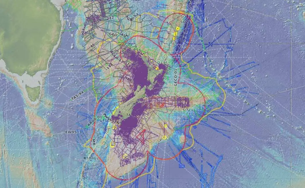
Bathymetric map – Credit : GNS

The continent stretches from latitude 19° south (north of tropical New Caledonia) to 56° south (south of New Zealand’s bleak subantarctic islands) and covers an area of 4,920,000 km2.

In 2017, geologists concluded that the submerged mass fulfilled the requirements to be classified as a drowned continent, rather than a microcontinent or continental fragment.

- Advertisement -

The interface consists of three multi-layered maps showing a compilation of data.

The Tectonic map reveals the geology of the continent, including the age of the crust, plate and microplate boundaries, sedimentary basins, and volcanoes. The Bathymetric map shows the shape of the seabed and depicts coastlines and identifies underwater features. The Geoscience data map plots GNS Science’s 1:250 000 onland geology and Petlab database sample locations.

Dr Nick Mortimer, lead author of the mapping interface said: “These maps are a scientific benchmark – but they’re also more than that. They’re a way of communicating our work to our colleagues, stakeholders, educators, and the public.” Mortimer added: “We’ve made these maps to provide an accurate, complete and up-to-date picture of the geology of the New Zealand and southwest Pacific area – better than we have had before.”

The mapping interface uses the GEBCO 2019 grid, the first output of the Seabed2030 project which is a global initiative to map the ocean floor of the entire world by 2030. The project is a collaboration between The Nippon Foundation in Japan and the General Bathymetric Chart of the Oceans (GEBCO). NIWA, GNS Science and Land Information New Zealand are jointly leading the South and West Pacific Ocean Regional Data Assembly and Coordination Centre, based in Wellington.

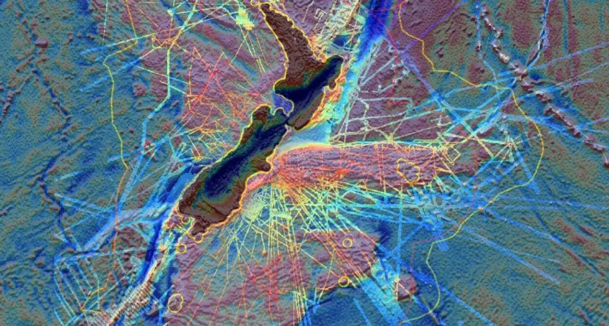
Explore Interface

- Advertisement -

Stay Updated: Follow us on iOS, Android, Google News, Facebook, Instagram, Twitter, Threads, TikTok, LinkedIn, and our newsletter

spot_img
Mark Milligan
Mark Milligan
Mark Milligan is a multi-award-winning journalist and the Managing Editor at HeritageDaily. His background is in archaeology and computer science, having written over 8,000 articles across several online publications. Mark is a member of the Association of British Science Writers (ABSW), the World Federation of Science Journalists, and in 2023 was the recipient of the British Citizen Award for Education, the BCA Medal of Honour, and the UK Prime Minister's Points of Light Award.
spot_img
spot_img

Mobile Application

spot_img

Related Articles

Monument linked to Iberian star mythology discovered in Jódar

Archaeologists from the Research Institute for Iberian Archaeology (IAI) at the University of Jaén (UJA) have discovered a monument connected to the sun and other celestial bodies within Iberian mythology.

Project is restoring Costa Rica’s mysterious stone spheres

A joint team of specialists from Costa Rica and Mexico are restoring three stone spheres at the Finca 6 Museum Site in Palmar de Osa.

Inscription sheds light on First Emperor’s quest for immortality

China’s First Emperor, Qin Shi Huang, was born in 259 BC in Handan, the capital of Zhao. He was originally named Ying Zheng, or Zhao Zheng, with ‘Zheng’ drawn from Zhengyue, the first month of the Chinese lunar calendar.

Artefacts from Battle of Dubienka unearthed near Uchanie

On July 18th, 1792, Polish forces under General Tadeusz Kościuszko clashed with Russian troops in what became one of the defining engagements of the Polish-Russian War.

Submerged port discovery could lead to Cleopatra’s lost tomb

Archaeologists have discovered a submerged ancient port near the ruins of the Taposiris Magna temple complex west of Alexandria, Egypt.

Archaeologists begin landmark study of Dzhetyasar culture settlements

Archaeologists from the Margulan Institute of Archaeology and the German Institute of Archaeology are conducting the first ever large-scale study of Dzhetyasar culture sites in Kazakhstan.

Study reveals arsenical bronze production during Egypt’s Middle Kingdom

A new open-access study published in Archaeometry unveils the first direct evidence of arsenical bronze production on Elephantine Island, Aswan, dating to Egypt’s Middle Kingdom (c. 2000–1650 BCE).

Hittite seals and tablets among new finds at Kayalıpınar

Archaeologists excavating the Hittite settlement of Kayalıpınar in Türkiye’s Sivas’ Yıldızeli district have unearthed a trove of cuneiform tablets and seal impressions.