Date:

Scientists tracking the ‘life signature’ of Britain

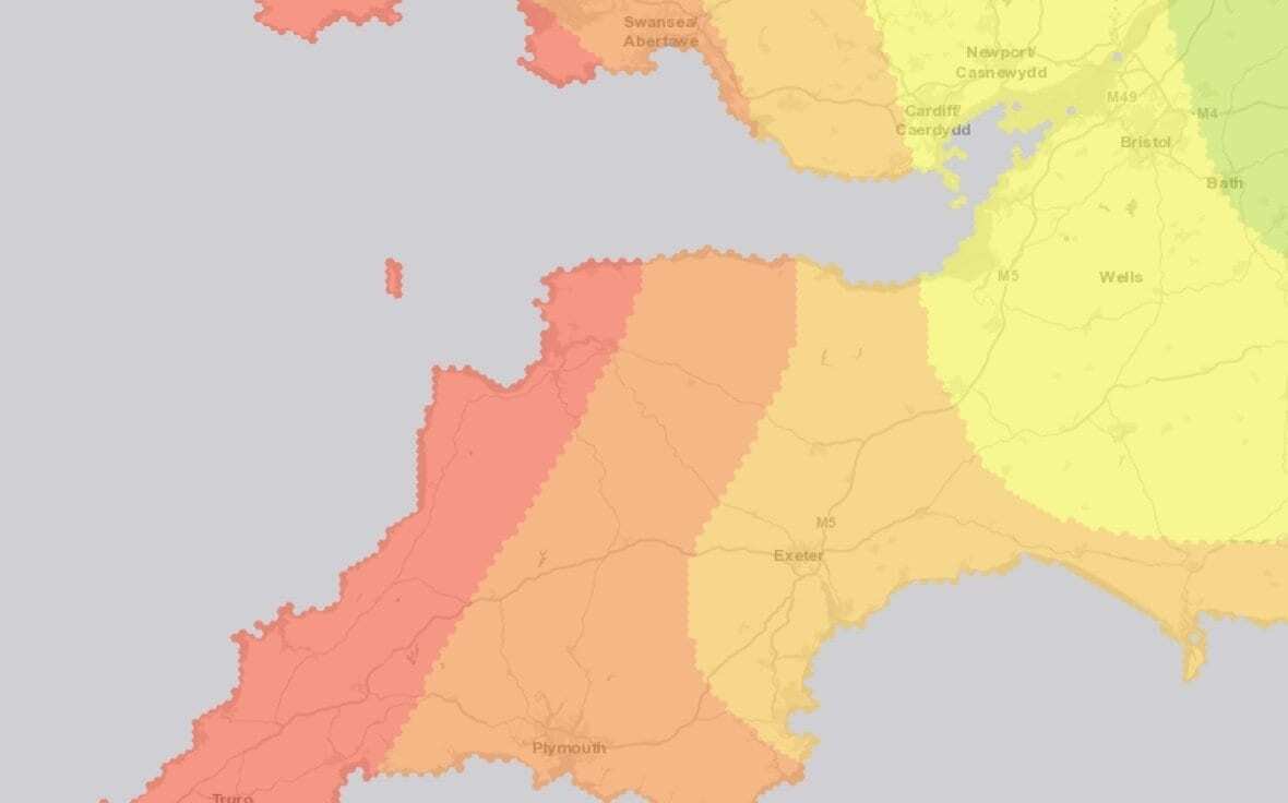
The British Geological Survey has just released a new interactive web tool that maps out the geographical variation in the isotope signatures of Britain.

This map, which includes strontium, oxygen and sulphur data, enables the determination of the provenance of food and drink or archaeological remains.

- Advertisement -

The fruit and vegetables we eat contain signatures or patterns depending on the type of ground in which they were grown. Britain has a very diverse but well-understood range of rock types, all with particular signatures, and so it is possible to match the composition of food to the geology on which it would have grown. This exciting method of analysing food can help us understand more about the provenance of the food on our plate or the grapes in our wine.

These signatures can also be passed on to humans when they eat the food, and are preserved in teeth as we grow from child to adult. By applying the same theory to archaeological remains, scientists can analyse the signatures in our ancestors’ teeth to begin to understand where they may have lived. For instance, the analysis may result in identifying that someone spent their childhood eating food from the eastern, coastal regions of Britain, or from granite highlands.

The Biosphere Isotopes Domains Map (GBV1), which is available via an interactive website, presents layers of information including strontium (Sr), oxygen (O) and sulphur (S) isotope compositions. These data can be viewed as an individual map layer, or together to determine the provenance of your fruit and veg. Using the different layers on the map it is possible to define a number of factors that characterise a geographical location. For example, it is possible to identify sparkling white wine that comes from grapes grown on the Chalk Downs near the sea.

Another major use for the website is in archaeology.

- Advertisement -

Elements ingested during childhood often have their ‘fingerprint’ preserved in the teeth of our ancestors. Following analysis of the teeth, users can input their data and the website will produce a map (that can be downloaded) showing the areas in Britain that best match the measurement.

This could narrow down the geographical location much in the same way that the game ‘Guess Who’ identifies your opponent’s character. – Access Map

British Geological Survey

Header Image – British Geological Survey

- Advertisement -

Stay Updated: Follow us on iOS, Android, Google News, Facebook, Instagram, Twitter, Threads, TikTok, LinkedIn, and our newsletter

spot_img
Mark Milligan
Mark Milligan
Mark Milligan is a multi-award-winning journalist and the Managing Editor at HeritageDaily. His background is in archaeology and computer science, having written over 8,000 articles across several online publications. Mark is a member of the Association of British Science Writers (ABSW), the World Federation of Science Journalists, and in 2023 was the recipient of the British Citizen Award for Education, the BCA Medal of Honour, and the UK Prime Minister's Points of Light Award.
spot_img
spot_img

Mobile Application

spot_img

Related Articles

Monument linked to Iberian star mythology discovered in Jódar

Archaeologists from the Research Institute for Iberian Archaeology (IAI) at the University of Jaén (UJA) have discovered a monument connected to the sun and other celestial bodies within Iberian mythology.

Project is restoring Costa Rica’s mysterious stone spheres

A joint team of specialists from Costa Rica and Mexico are restoring three stone spheres at the Finca 6 Museum Site in Palmar de Osa.

Inscription sheds light on First Emperor’s quest for immortality

China’s First Emperor, Qin Shi Huang, was born in 259 BC in Handan, the capital of Zhao. He was originally named Ying Zheng, or Zhao Zheng, with ‘Zheng’ drawn from Zhengyue, the first month of the Chinese lunar calendar.

Artefacts from Battle of Dubienka unearthed near Uchanie

On July 18th, 1792, Polish forces under General Tadeusz Kościuszko clashed with Russian troops in what became one of the defining engagements of the Polish-Russian War.

Submerged port discovery could lead to Cleopatra’s lost tomb

Archaeologists have discovered a submerged ancient port near the ruins of the Taposiris Magna temple complex west of Alexandria, Egypt.

Archaeologists begin landmark study of Dzhetyasar culture settlements

Archaeologists from the Margulan Institute of Archaeology and the German Institute of Archaeology are conducting the first ever large-scale study of Dzhetyasar culture sites in Kazakhstan.

Study reveals arsenical bronze production during Egypt’s Middle Kingdom

A new open-access study published in Archaeometry unveils the first direct evidence of arsenical bronze production on Elephantine Island, Aswan, dating to Egypt’s Middle Kingdom (c. 2000–1650 BCE).

Hittite seals and tablets among new finds at Kayalıpınar

Archaeologists excavating the Hittite settlement of Kayalıpınar in Türkiye’s Sivas’ Yıldızeli district have unearthed a trove of cuneiform tablets and seal impressions.