
Electrical images show flows of fluids to magma chamber.
Through measuring the speed that the Earth conducts electricity and seismic waves, a University of Utah researcher, and colleagues, made a detailed picture of Mount Rainier’s deep volcanic plumbing and partly molten rock that will erupt again someday.
“This is the most direct image yet capturing the melting process that feeds magma into a crustal reservoir that eventually is tapped for eruptions,” says geophysicist Phil Wannamaker, of the university’s Energy & Geoscience Institute and Department of Civil and Environmental Engineering. “But it does not provide any information on the timing of future eruptions from Mount Rainier or other Cascade Range volcanoes.”
The study was published in the journal Nature by Wannamaker and geophysicists from the Woods Hole Oceanographic Institution in Massachusetts, the College of New Jersey and the University of Bergen, Norway.
In a strange turn of events, the image appears to show that at least part of Mount Rainier’s partially molten magma reservoir resides approximately 6 to 10 miles northwest of the 14,410-foot volcano, which is 30 to 45 miles southeast of the Seattle-Tacoma area.
Wannamaker says a possible reason for this is due to the 80 electrical sensors used for the experiment were placed in a 190-mile-long, west-to-east line about 12 miles north of Rainier. So the main part of the magma chamber could be directly below the peak, but with a lobe extending northwest under the line of detectors.
The top of the magma reservoir in the image is 5 miles underground and “appears to be 5 to 10 miles thick, and 5 to 10 miles wide in east-west extent,” he says. “We can’t really describe the north-south extent because it’s a slice view.”
According to Wannamaker’s predictions the reservoir is roughly 30 percent molten. Magma chambers are like a sponge of hot, soft rock containing pockets of molten rock.
The new image does not reveal the plumbing tying Mount Rainier to the magma chamber located 5 miles below it. Instead, it displays water and partly molten and molten rock are generated 50 miles underground where one of Earth’s seafloor crustal plates or slabs is “subducting” or diving eastward and downward beneath the North America plate, and how and where those melts rise to Rainier’s magma chamber.
The National Science Foundation’s Earthscope programme funded the study, which also made underground images of the United States using seismic or sound-wave tomography, much like CT scans show the body’s interior using X-rays.
The new study used both seismic imaging and magnetotelluric measurements, which make images by showing how electrical and magnetic fields in the ground vary due to differences in how much underground rock and fluids conduct or resist electricity.
Wannamker states that it is the most detailed cross-section view yet under a Cascades volcanic system using electrical and seismic imaging. Earlier seismic images indicated water and partly molten rock atop the diving slab. The new images show melting “from the surface of the slab to the upper crust, where partly molten magma accumulates before erupting,” he adds.
Wannamaker and Rob L.Evans, from the Woods Hole Oceanographic Instituation, conceived the study. First author R Shane McGary- then at Woods Hole and now the College of New Jersey- conducted the data analysis. Other co-authors were Jimmy Eisenbeck of Woods Hole and Stéphane Rondenay from the University of Bergen.
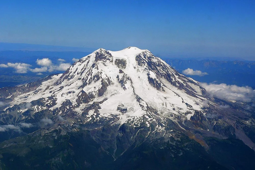
Mount Rainier: Hazardous Backdrop to Metropolitan Seattle- Tacoma
Mount Rainier, the tallest peak in Cascades, “is an active volcano that will erupt again,” says the U.S. Geological Survey. Rainier resides atop volcanic flows up to 36 million years old. An ancestral Rainier existed 2 million to 1 million years ago. The mountain’s modern edifice was constructed due to frequent eruptions during the past 500,00 years. During the past 11,000 years, Rainier has experienced multiple explosive eruptions, spewing ash and pumice.
Rainier was once a tall volcano until it collapsed during an eruption 5,600 years ago to form a large crater open to the northeast, similar to the crater formed by Mount St Helens’ 1980 eruption. The 5,600-year-old eruption sent a huge mudflow west to Puget Sound, covering parts or all of the present site of the Port of Tacoma, Seattle suburbs and Kent and Auburn, and the towns Puyallup, Orting, Buckley, Sunner and Enumclaw.
Rainier’s last lava was 2,200 years ago, the last flows of hot rock and ash occurred 1,100 years ago and the last big mudflow was 500 years ago. Also there are disputed reports of steam eruptions in the 1800s.
Subduction Made- and a Peek beneath a Peak
The “ring of fire” is a zone of active volcanoes and frequent earthquake activity surrounding the Pacific Ocean. It is located where the Earth’s tectonic plates collide- specifically, plates that make up the seafloor converge with plates that carry continents.
From Cape Mendocino in northern California and north past Oregon, Washington State and into British Columbia, an oceanic plate is being pushed eastward and downward- a process called subduction-beneath the North American plate. This relatively small Juan de Fuca lies between the huge Pacific plate and the Pacific Northwest.
New seafloor rock- rich with water and cracks and minerals-emerges from an undersea volcanic ridge 250 miles off the coast, from Northern California into British Columbia. That seafloor adds to the western edge of the Juan de Fuca plate and pushes it east-northeast under the Pacific Northwest, as far as Idaho.
The particular part of the plate diving eastward and downward is called the slab, which ranges from 30 to 60 miles thick as it is stuck under the North American plate. The part of the North American plate above the diving slab is shaped like a wedge.
When the leading, eastern edge of the diving slab descends so deep where the pressures and temperatures are high, water-bearing minerals such as chlorite and amphibole release water from the slab, and the slab and surrounding mantle rock start to melt. This is the reason the Cascade Range of active volcanoes extends north-to-south, above the slab and parallel but approximately 120 miles inland from the coast, from British Columbia south to Mount Shasta and Lassen Peak in northern California.
In the new image, yellow-orange-red areas correspond to higher electrical conductivity (or lower resistivity) in places where fluids and melts are located.
The underground image created by the new study displays where waters and molten rock accumulate atop the descending slab, and the route they undertake to the magma chamber that feeds eruptions of Mount Rainier:
The rock starts to melt atop the slab approximately 50 miles beneath Mount Rainier. Wannamaker says it is best described as partly molten rock that contains 2 percent water and “is a mush of crystals within an interlacing a network of molten rock.”
Some of the water and partly molten rock gets dragged downwards atop the descending slab, to depths of 70 miles or possibly more.
Other partly molten rock rises up through the mantle wedge and crosses into the crust at a depth of approximately 25 miles, it then rises into Rainier’s magma chamber- or at least the lobe of the chamber that crosses under the line of sensors used in the study. Evidence collected suggests that the magma moves upward at a rate of at least 0.4 inches per year.
The new magnetotelluric image also exposes a shallow zone of fluid about 60 miles west of Rainier and 25 miles deep at the crust-mantle boundary. Wannamaker says it is mainly water released from minerals as the slab is squeezed and heated as it dives.
The seismic data was collated during 2008-2009 for other studies. The magnetotelluric data were gathered during 2009-2010 by authors of a new study.
Wannamaker, a long with his colleagues, placed an east-west line of magnetotelluric sensors: 60 that made one-day measurements and appeared as deep as 30 miles into the earth, and 20 that made measurements for a month and looked at even greater depths.
Contributing Source: University of Utah
Header Image Source: Wikimedia


