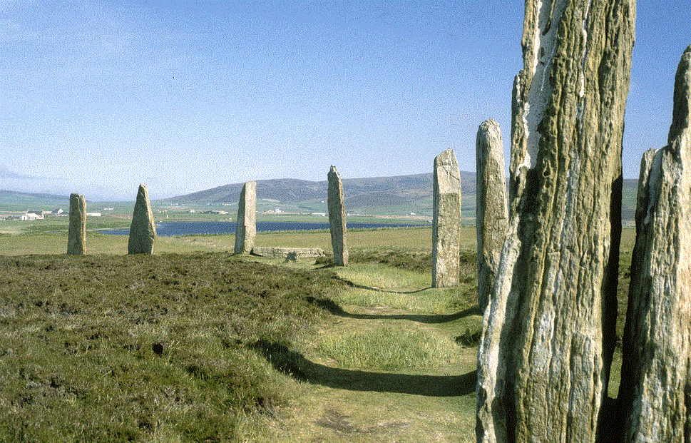
Archaeologists carrying out underwater surveys with remote sensing and seismic profiling near the Ring of Brodgar have discovered a possible submerged stone circle.
Seismic images have revealed a large circular feature beneath the waves which would have been submerged as sea levels rose in the Loch around 2000BC).
Surveys of the Bay of Firth has also revealed another anomaly – a 40-metre circular mound that could also be a structure of prehistoric age such as a chambered tomb.
A diving team of archaeologists plan to investigate the rounded stone circle feature with Aberdeen University archaeologist Caroline Wickham-Jones stating “These are very preliminary results and a lot more work is needed. Nevertheless, there does seem to be a ring-shaped feature.”
“It might suggest a previous incarnation of the Ring of Brodgar which was later rebuilt on higher ground as the sea came into the loch and the water levels rose.”
The marine survey has already revealed the changes in land formation and sea level rises for the region during the Mesolithic period (8000BC), where the Bay of Firth and Damsay was mainly dry land, through to the late Neolithic/Bronze Age (2000BC) where the sea had filled all the low lying areas.
Wickham-Jones said: “A lot of the hunter-gather settlement was along the coast and these areas have been submerged, so the evidence from Orkney is underwater. However, when they are flooded, not all of it gets destroyed, some sites may have survived and we may get to see them.
The assemblage of monumental Neolithic structures in Orkney is without parallel in the United Kingdom and on the Orkney Mainland provides an entire landscape of features from this period. During this time, complex new societies came to the fore that were a radical departure from the earlier hunter-gatherers and which were capable of creating substantial structures.
The Neolithic in Scotland lasted from approximately 4000 to 2200 BC and Orkney as a whole has nearly 3,000 identified Neolithic sites all told. British archaeologists have often interpreted this era as having two distinct phases; the Earlier Neolithic dominated by regional styles of pottery and architecture followed by a relatively abrupt change into the Later Neolithic characterised by new traditions found throughout the British Isles that incorporate structures on a grander scale.
In the Orcadian context, there are definite developments during the Neolithic, but the changes are gradual and tend to build on earlier ideas rather than appearing to form two distinct periods. The great Orcadian Neolithic monuments were constructed contemporaneously with the emergence of the Ancient Egyptian culture, more than 500 years before the building of the Great Pyramid of Giza and almost a millennium before the sarsen stones of Stonehenge were erected.
Background of the Ring of Brodgar:
The Ring of Brodgar (or Brogar, or Ring o’ Brodgar) is a Neolithic henge and stone circle in Orkney, Scotland. Most henges don’t contain stone circles; Brodgar is a striking exception, ranking with Avebury (and to a lesser extent Stonehenge) among the greatest of such sites. The ring of stones stands on a small isthmus between the Lochs of Stenness and Harray.
These are the northernmost examples of circle henges in Britain. Unlike similar structures such as Avebury, there are no obvious stones inside the circle, but since the interior of the circle has never been excavated by archaeologists, the possibility remains that wooden structures, for example, may be present. The site has resisted attempts at scientific dating and the monument’s age remains uncertain. However, it is generally thought to have been erected between 2500 BC and 2000 BC, and was, therefore, the last of the great Neolithic monuments built on the Ness. A project called The Ring of Brodgar Excavation 2008 was undertaken in the summer of the year in an attempt to settle the age issue and help answer other questions about a site that remains relatively poorly understood. The results of the excavation are still preliminary.
The stone circle is 104 metres (341 ft) in diameter, and the third largest in the British Isles. The ring originally comprised 60 stones, of which only 27 remained standing at the end of the 20th century. The tallest stones stand at the south and west of the ring.
The stones are set within a circular ditch up to 3 metres (9.8 ft) deep, 9 metres (30 ft) wide and 380 metres (1,250 ft) in circumference that was carved out of the solid sandstone bedrock by the ancient residents. Technically, this ditch does not constitute a true henge as there is no sign of an encircling bank of earth and rock. However, many archaeologists continue to refer to this structure as a henge; for example, Aubrey Burl classifies the ditch as a Class II henge; one that has two opposing entrances, in this case on the north-west and south-east.
Examination of the immediate environs reveals a concentration of ancient sites, making a significant ritual landscape. Within 2 square miles (5.2 km2) there are the two circle-henges, four chambered tombs, groups of standing stones, single stones, barrows, cairns, and mounds.
The immediate area has also yielded a number of flint arrowheads and broken stone mace-heads that seem to date from the Bronze Age. Although its exact purpose is not known, the proximity of the Standing Stones of Stenness and its Maeshowe tomb make the Ring of Brodgar a site of major importance. The site is a scheduled ancient monument and has been recognized as part of the “Heart of Neolithic Orkney” World Heritage Site in 1999.
Header Image Credit : Greg Willis


