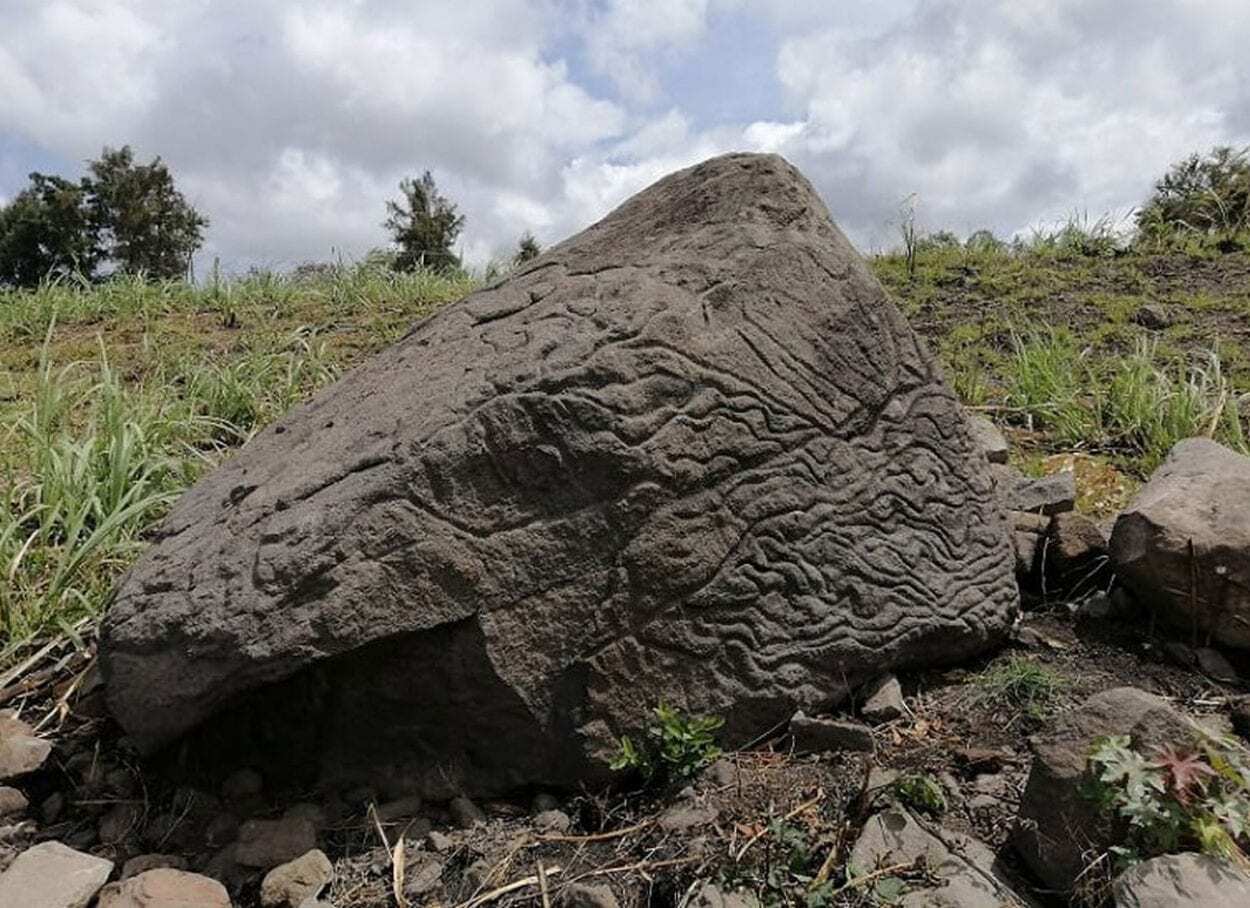
Archaeologists from the Instituto Nacional de Antropología e Historia (INAH) have announced the discovery of a stone map that dates from between 200 BC and AD 200 in Colima, Mexico.
The map represents the territory of Pre-Columbian natives living around Colima (evident by small circular features that shows the position of ancient settlements), that was carved on a basalt volcanic rock deposited in situ after being thrown from an ancient eruption at the Colima volcano some 14km away.
The stone, measures 1.7 metres in height and sits on an axis of approximately 20 ° to the northeast and is orientated towards the volcano.
Head of the INAH, Julio Ignacio Martínez de la Rosa reports that the identification of the map is based on a study of the designs and patterns as well as a comparison to similar petroglyphs found in the region. The stone has carved hollows that represent villages, as well as lines that can be associated with natural orographic and hydrological features.
Inspection of the map has been conducted by Archaeologist Rafael Platas Ruiz who has found that some features also correspond with the geographical landscape of the southern slope of the Colima volcano, with ravines and rivers clearly apparent.
Rafael Platas Ruiz said: Without a doubt, these ‘map-stones’ helped to understand and facilitate the management of the land. Furthermore, they were a way of preserving knowledge from one generation to another, at a time when writing did not exist in the territory that is today Colima ”.
Archaeologists determined that the context dating doesn’t correspond with the Chanal or Postclassic Colimense phase (1000–1500 AD) and instead has drawn comparisons to early tombs from the Late Preclassic and Early Classic periods between 200 BC and AD 200.
Header Image Credit : Rafael Platas Ruiz


